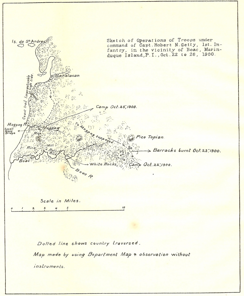
Back in 1900, the road to Balanacan as we know it today, did not exist. The U.S. Army marched along the coastline from Mogpog town to get there. This is shown on a map drawn by Captain Robert Getty and mentioned in his report. His trip back to Mogpog seems to describe the road from Balanacan to Mendez, Pili, Banto and then back to Mogpog town proper.