The AP (associated press) photo below was the first nationwide photographic exposure in the United States to the Moriones. It could be found in almost every newspaper during April of 1979.

The History of Marinduque from Ulong Beach

The AP (associated press) photo below was the first nationwide photographic exposure in the United States to the Moriones. It could be found in almost every newspaper during April of 1979.
NAIROBI, 22 May 2024
On the occasion of the Philippine National Heritage Month and the World Day for Cultural Diversity for Dialogue and Development (21 May), the Philippine Embassy in Nairobi participated in the “Masks of the World” exhibition at the Nairobi National Museum, organized by the Embassy of Romania in Nairobi and the Kenya National Commission for UNESCO (KNATCOM).
Officials from the Kenyan Parliament, Ministry of Foreign and Diaspora Affairs, National Museums of Kenya, and KNATCOM, as well as members of the diplomatic corps and students joined the opening ceremony on 21 May 2024.
The Philippine Embassy showcased a Morion head mask crafted by Mr. Gilbert Monsanto, a local artist from Mogpog town in Marinduque.
The Morion mask is an important piece of Philippine cultural heritage that is worn during the Moriones Festival, which takes place annually in Marinduque during Holy Week. Participants in the festival wear these masks and reenact the story of Saint Longinus, a Roman centurion who purportedly pierced Jesus Christ’s side during the crucifixion and converted to Christianity after being cured of blindness by Christ’s blood, symbolizing both penance and celebration.
In Mogpog, a Morion mask is traditionally worn with a bulaklakan turban. It is named after the flowers made from various colors of Japanese paper and attached to the headgear. The number of flowers on the turban indicates how many years a person will participate in the Moriones. Each year, they remove a flower from their turban after completing the ritual. Removing the last flower signifies the fulfillment of their vow.
Other masks featured at the exhibition include those from Romania, Thailand, Mexico, and Costa Rica. The exhibition will run from 21 to 26 May 2024. END
PH Ambassador Marie Charlotte G. Tang (wearing a light blue blazer) presents the Morion head mask to the guests and briefly informs them of its origin.
A Morion mask is typically made from the wood of dapdap, dita, or santol trees, which are abundant in Marinduque. The mask painting and drying process takes about two weeks.


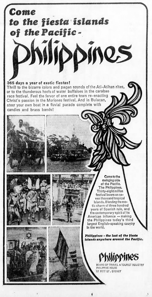
Moriones advertisement is in the Age Magazine, February 19, 1973. The ad is sponsored by the Philippines Board of Travel and Tourist Industry, Philippine House, Sydney, Australia.
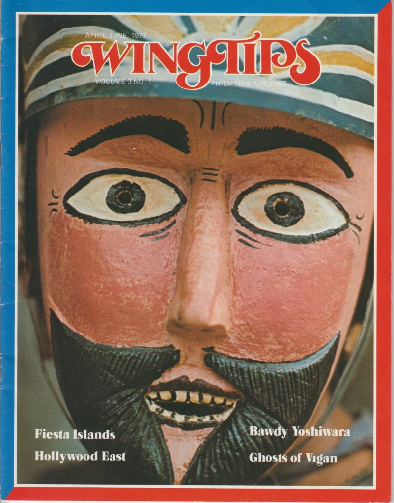
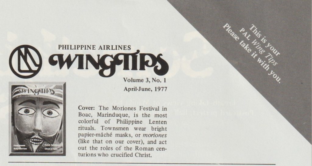
Philippine Airlines April-June 1977 edition of their Wingtips magazine featuring the Moriones Festival on the cover.
From the 2025 Indomie PH Instagram account.
Taglines for the advertisement:
Feel the heartbeat of the Moriones Festival as tradition comes alive with every best of the drum.
Let’s revel in the vibrant parades, the colorful masks, and the fiery passion that fills the streets. And what better way to fuel our Kalndomie spirts that with bold savory taste of IndomieMiGoreng?
Ignite your fiesta with a pack of Indomie! Grab yours now via link in bio and savor the flavor that matches the festival’s energy!

From the 2024 Instagram account of Miguel and Maria group of restaurants.
Discover a world of rich culture and one-of-a-kind cuisine with our take on Marinduque classics, available at Unlimited Mornings for all weekends of April. Take a trip into the flavorful history of the Moriones Festival for 598/head.

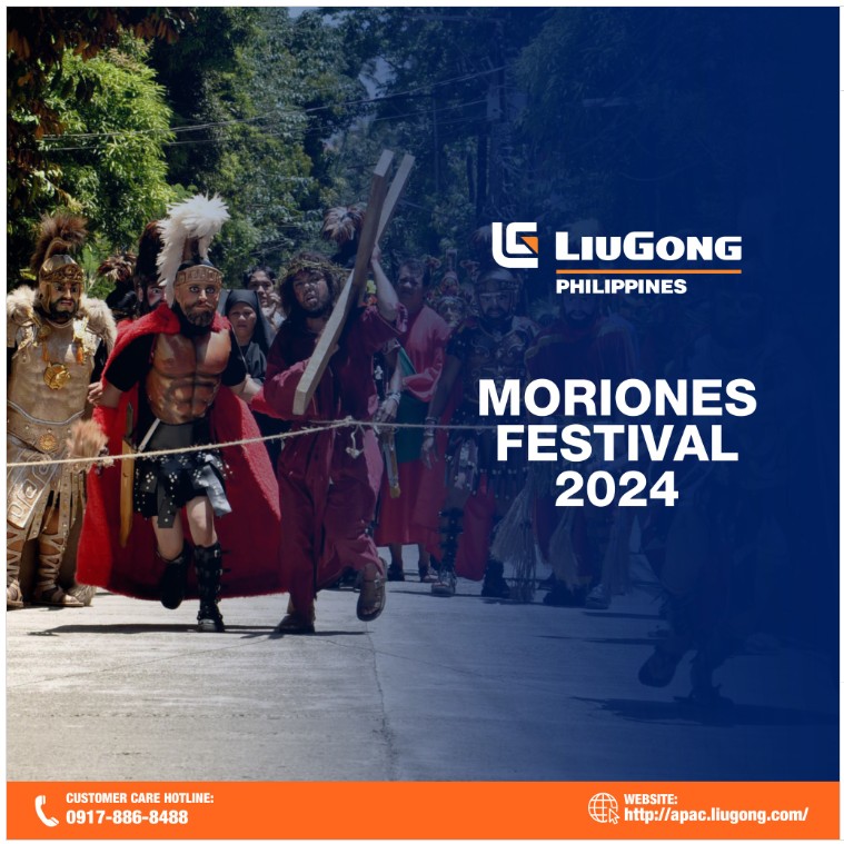
lFrom the Liugong_ph instagram account
HAPPY MORIONES FESTIVAL 2024!
March marks the beginning of Holy Week this year, and for those seeking a place to contemplate the occasion, the Moriones Festival in Marinduque province is an ideal destination. The religious festival commences on Holy Monday and concludes on Easter Sunday. The people of Marinduque have the opportunity to take part in the reenactment of the search for Saint Longinus by Roman soldiers. During the festival, participants wear costumes, helmets, or masks that resemble those worn by Imperial Roman soldiers.
Grilla Philipine Cusine 2017 Facebook page
Let’s celebrate the Moriones Festival of Marinduque here at Grilla. See you there!

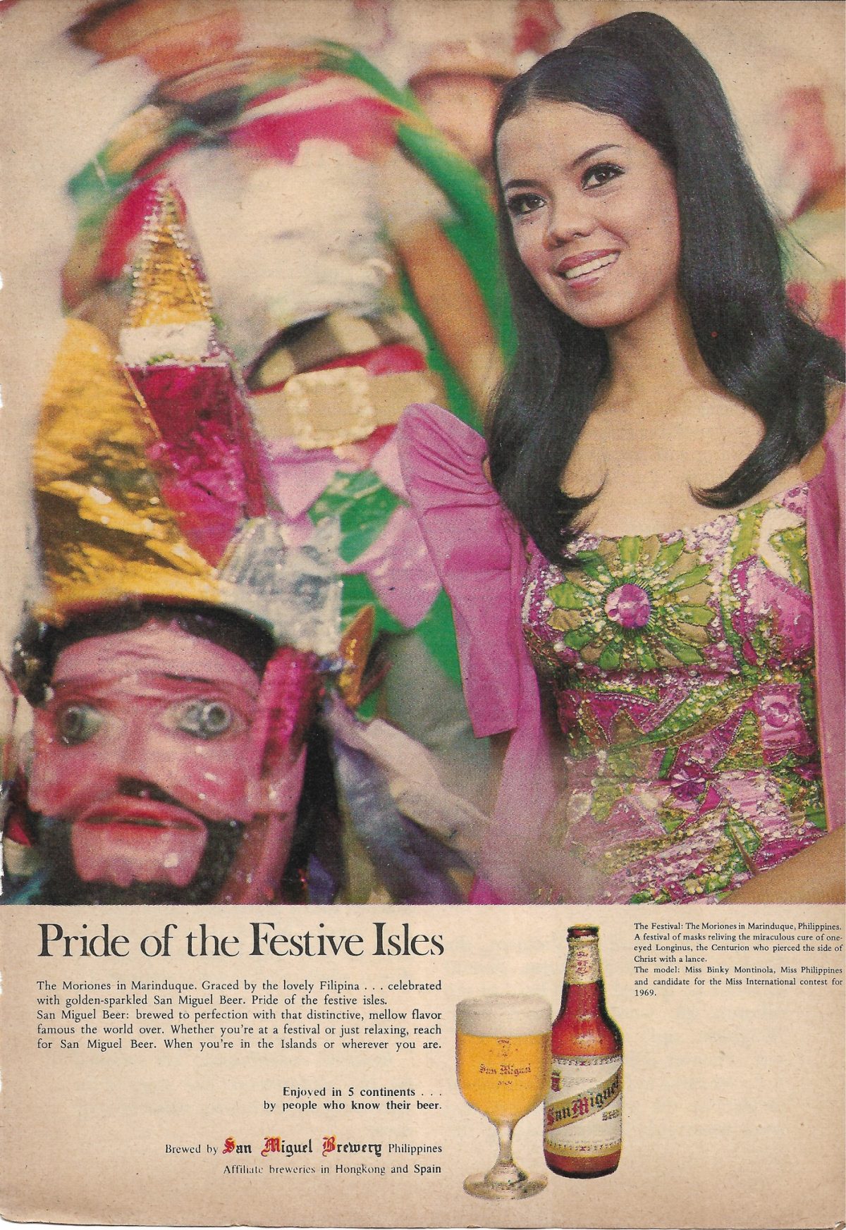
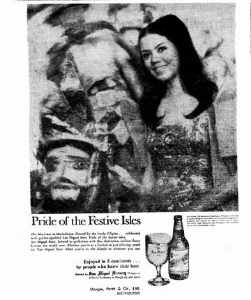
Beer, a beauty queen and the Moriones.
From:
B & W copy -Papua New Guinea Post Courier October 26 1970 Color copy Readers Digest Philippines 1970
Pride of the Festive Isles
The Moriones in Marinduque. Graced by the lovely Filipina . . . celebrated with golden-sparkled San Miguel Beer, Pride of the festive isles. San Miguel Beer: brewed to perfection with that distinctive, mellow flavor famous the world over. Whether you’re-at a festival or just relaxing, reach for San Miguel Beer. When you’re in the Islands or wherever you are.
Enjoyed in 5 continents . . .by people who know their beer.
Brewed by, San Miguel Breweries Philippines Affiliate breweries in Hongkong and Spain Morgan, Perth fit Co., Ltd. DISTRIBUTOR
Small print under picture
The festival in Marinduque Philippines. A festival of masks reliving the miraculous cure of the on eyed Longinus, the centurion who pierced the side of Christ with a lance. The model: Binky Montinola, Miss Philippines, candidate for the Miss International Contest for 1969.

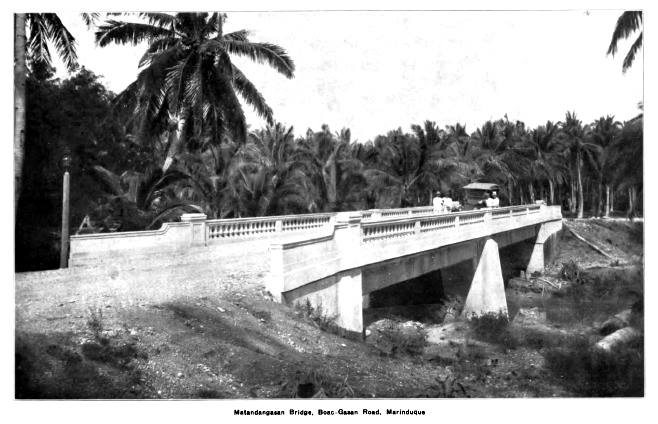
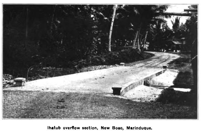
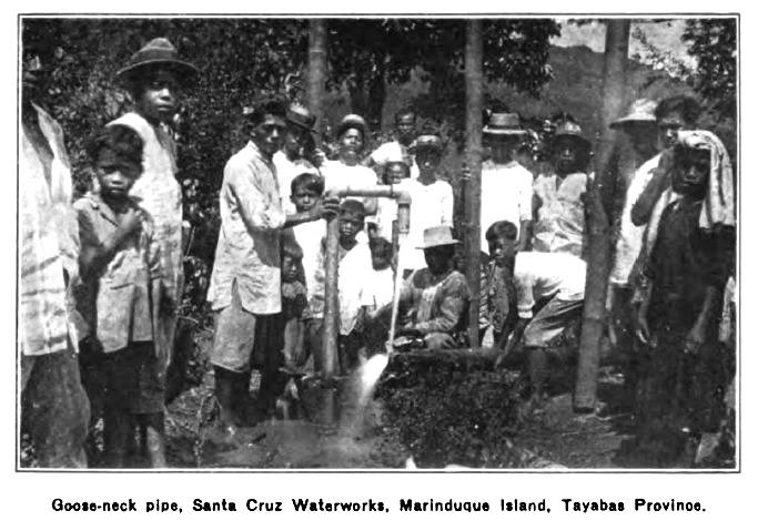
Matandangasan Bridge, Ihatub Overflow, Fountain at Boac and Santa Cruz Waterworks. Can we find these locations today and take a now picture.

If you live in Marinduque or have ever visited the island you most likely have used the port facilities in Balanacan, Mogpog. You may also have taken a walk over to the statue of Our Lady of BIGLANG-AWA while waiting to board one of the ships. Hidden from view are the remains of Japanese warships that were sunk in the vicinity. What else could be hidden there? Maybe the true name of this harbor in Marinduque.
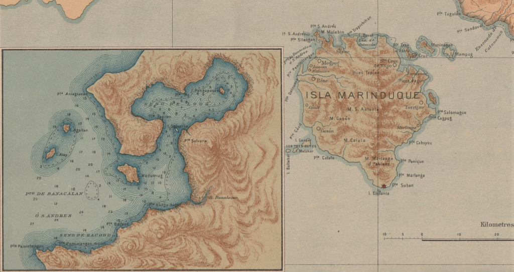
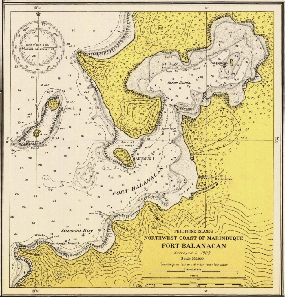
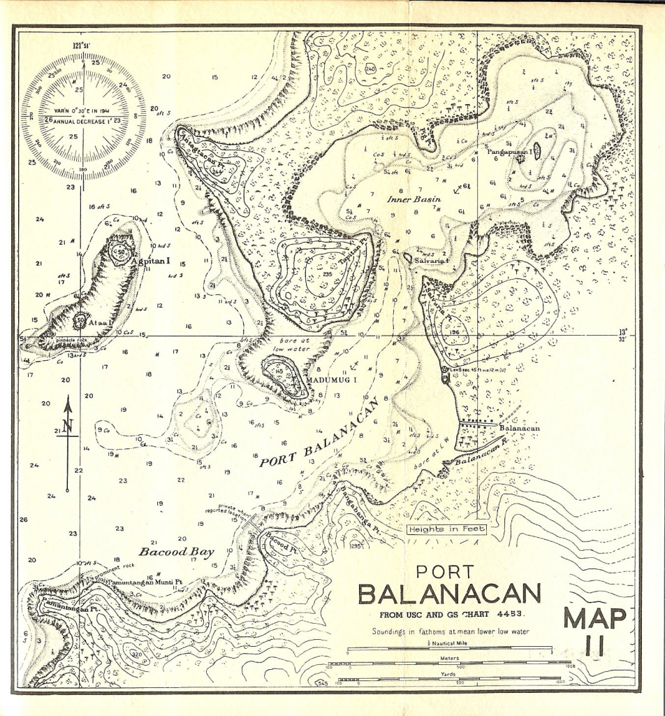
Did you know that Balanacan is not the original name of this area?
Although this port was recognized early on as a perfect area to shelter vessels, it was not widely used as a port of commerce until a paved road was completed in 1918. Up until that time only a dirt trail connected it with the nearest town, Mogpog.
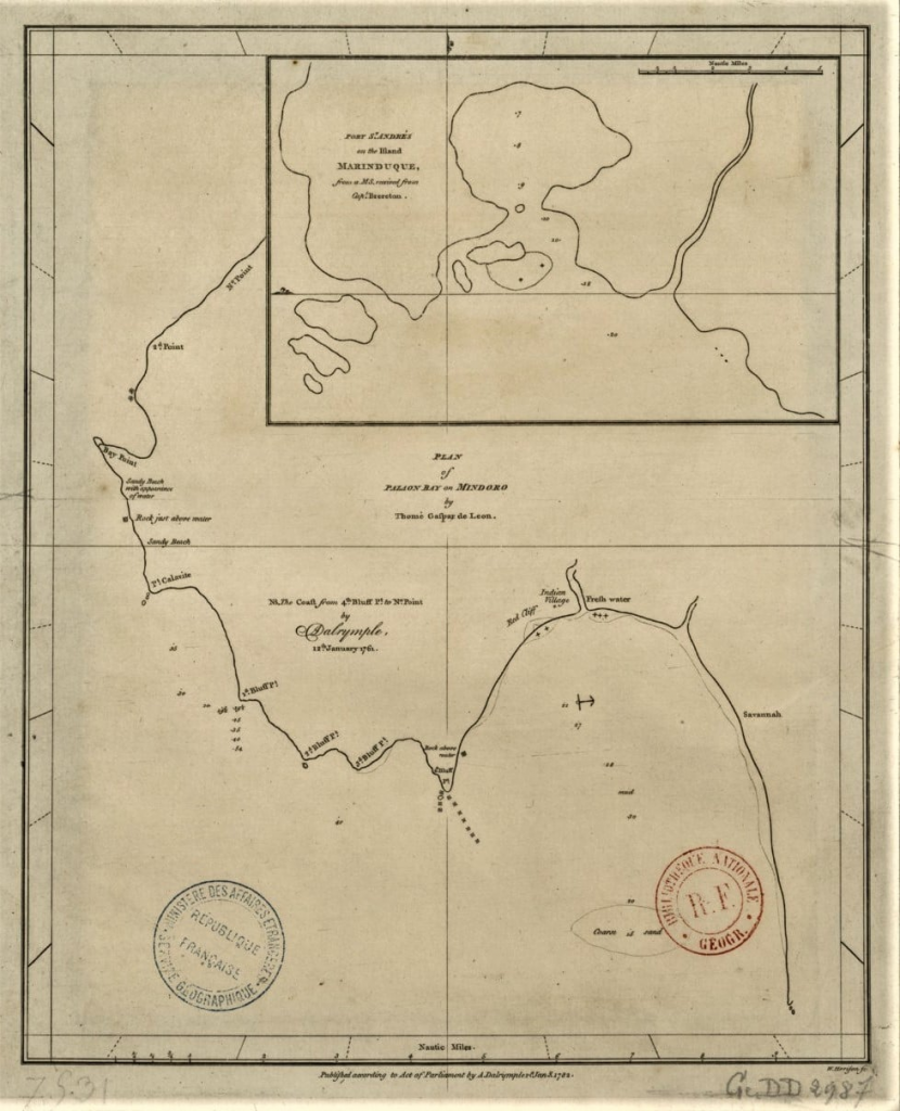
Puerto de San Andres
The first recorded name I could locate that is associated with this natural harbor area is that of Puerto de San Andres. The name was first published in a 1761 map by Captain William Brereton of the British Navy. It contains little detail other than soundings for the entrance channel. In a Spanish map from 1841 entitled De una parte de la cost sur de la Isla de Luzon we see the name and again it lacks detail but must be noted as important as it is one of only a few locations shown on the island of Marinduque.
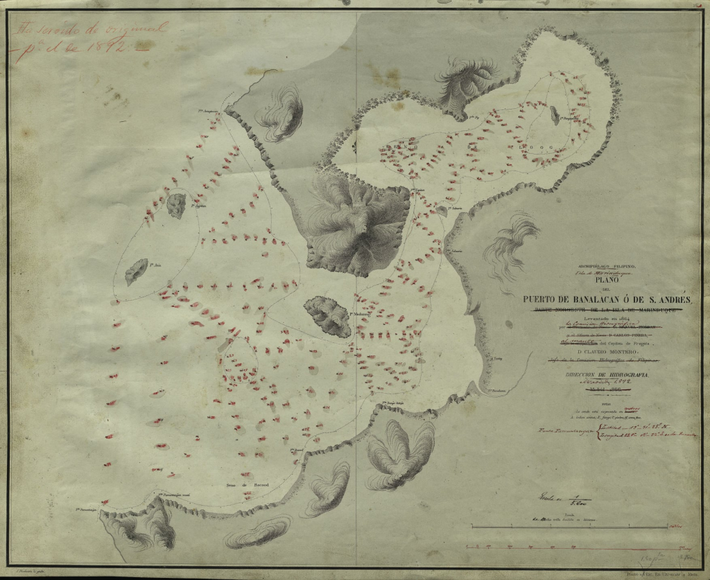
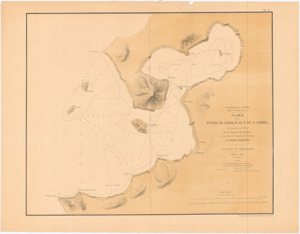
The name San Andres would be associated with the port up until the end of the 1800’s and could be found on Spanish maps from 1866, 1892 and a map from the Manila Observatory from 1899. The 1866 map is the first detailed map of the port with soundings, terrain features and place names.
Banalacan
The second name that could be found was that of Banalacan which was first used in 1866 and was associated with Puerto San Andres and could be used as either/or up until 1899. The Spanish 1866 map is entitled Plano Del Puerto de Banalacan o de St Andres and as is noted in the section for San Andres is the first detailed map of the port with soundings, terrain features and place names.
The name is used again in the revised edition of this map from 1892. In a 1900 sketch of operations by Capt Robert Getty 1st Infantry United States Volunteers the spelling Banalacan is used by Americans local on the island. It should be noted that American forces were dependent of Spanish maps so most place names were taken from those maps.
In 1901 in a publication from the United States Board on Geographic Names relating to The Geographic Names in the Philippine Islands Banalacan is still used.
The last reference to Banalacan I could locate was in a 1908 publication from the U.S. War Department Annual Report, volume 8.
Banacalan
The third name to be found and the oddball of the group is that of Banacalan. It is first found in an undated map from the Norris Peters Company, Washington D.C. and is noted as taken from a Spanish survey in 1864 which would most likely be the Spanish 1866 map is entitled Plano Del Puerto de Banalacan o de St Andres.
The 1899 map from the Manila Observatory Atlas of the Philippine Islands also lists the port as Pto de Banacalan o San Andres. I could not locate any other uses of Banacalan and maybe is a misspelling of Banalacan that was being used at the time.
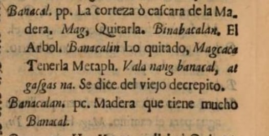
I did find Banacalan in the book entitled Vocabulario de la lengua Tagala written by the Jesuits in 1754. The English translation of the Spanish translation is “wood that has a lot of bark”.
If it is not a misspelling this may have some significance since there is speculation that the port was used by the Spanish to build and repair their Galleons.
Balanacan
The fourth name is what we know the port as today, Balanacan. When exactly and why the name was changed from the previous usage I could not determine.
The first use was found in the 1896 Spanish publication Catalogo Sistematico de Toda La Fauna De Filipinas. The first and subsequent use by the Americans was found in the publication of the 1903 Census of the Philippine Islands. It could be found again in the 1905 Annual Reports of the War Dept. Volume 12. The first American map to use Balanacan was the 1908 map produced by the US Geodetic Survey. Balanacan was still use found in the US Army Map 11 dated 1944 during World War 2.
Baranakan
I would call this a “interesting side note” since I did not find any use of Baranakan other than in the U.S. publication from WW2 Japanese Equivalents for Place Names.


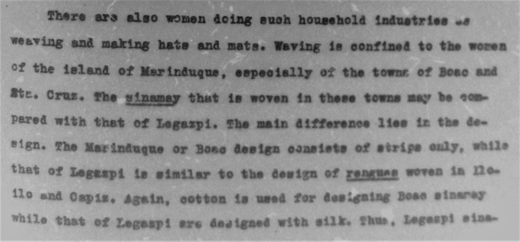
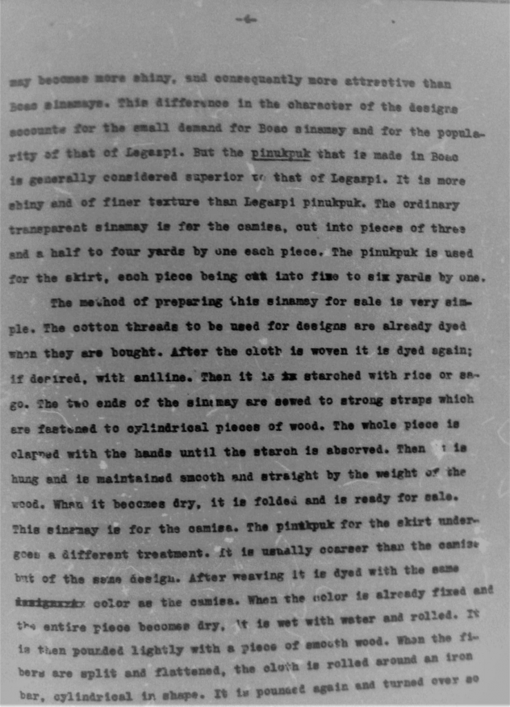
In 1916 Marinduque was part of the Province of Tayabas. On pages 3,4 and 5 of Alzona’s paper there is a discussion concerning Sinamay use in Marinduque and The Boac Terno. Sadly there are no illustrations in the paper.

Shown below is a postal cover which commemorates the first air-mail flight to Marinduque, October 30, 1931.
Research has shown the addressee, Major I. F. Peak, as a Flight Surgeon in the U.S. Army Air Corps stationed in Fort Nichols in Manila.
Information found from the Airpost Journal, February 1932, Page 27 report of Philippine First Flights is as follows:
The U.S. Army Air Corps (squadron stationed at Clark Field) Fort Stotsenburg has been lately very active with pioneering new Air-trails or new routes, and made several First Flights and pioneers, transporting Air Mail in due official way, previous announcement and corresponding permits or authorization in very case from the Bureau of Posts of the Philippine Government and in accordance of Rules and Regulations established. All were carried in mail bags as regular official Air-Mail, with its proper Way-bills of Dispatch, etc.
Several of these First flight covers to various points in the Philippines can be located during the 1931 timeframe.
Where exactly the airplane landed in Boac (if it did) is a mystery. A Post war photo I have shows a very primitive air strip located somewhere along the Boac River. It is also possible that the mail bag was air dropped as was documented in other locations.

Check out the replies to the Marinduque food “scandal” from April of 1937 as printed in the Tribune Newspaper.


September 9 of 1933 found Marinduque in the middle of a financial crisis causing the provincial treasurer to hold up funds. The office of interior and labor in Manila had to send a representative to help out.